Mañagaha Marine Conservation Area
| About MMCA | Managaha | CoralWatch | Project's Progress | Volunteer | Contact |
ABOUT MMCA
 The Marianas archipelago consists of 15 small islands immediately South of the Marianas Trench Marine National Monument. About 90% of the Commonwealth's population of 69,000 (CNMI Census, 2000) reside on Saipan, where hundreds of thousands of tourists are welcomed every year. Saipan's western shore comprises of approximately 11.9 square miles with a benthic habitat of diverse coral and large seagrass beds (Van Beukering, 2006). Over 250 species of fish have been recorded in more than 24 lagoon habitats (Amesbury et al, 1979) and as many as 11 vulnerable, threatened or endangered species live in these waters. Saipan's rich reefs and habitats are at risk from land based pollution, over-fishing, and climate change.
Geared towards the local communities and off-island visitors, this project aims to
1. Establish a community network of environmental stewards that promotes sustainable approaches and behaviors within the Managaha Marine Conservation Area (MMCA)
2. Support and strengthen the function of the Managaha Marine Conservation Area by prioritizing broad-scale learning programs for biodiversity protection and climate change adaptation
3. Increase and amplify support for the Micronesia Challenge in the CNMI
MINA hopes that this program will continue to attract many visitors to return to the CNMI and continue to enhance their Managaha experience by advocating for the protection of marine life and advancing the Micronesia Challenge.
Project Goals
1. Conduct education & outreach activities
|
|
To build public support for and compliance with coral reef management efforts, education and outreach activities will be conducted on both Saipan and Managaha. |
2. Promote key aspects of the MMCA and the Micronesia Challenge:
|
|
We will answer the questions: -What is the MMCA? -What are MPAs? -What is the Micronesia Challenge? -Why does the MMCA matter? -How can the community and tourists help? |
3. Collect valuable information about the marine environment
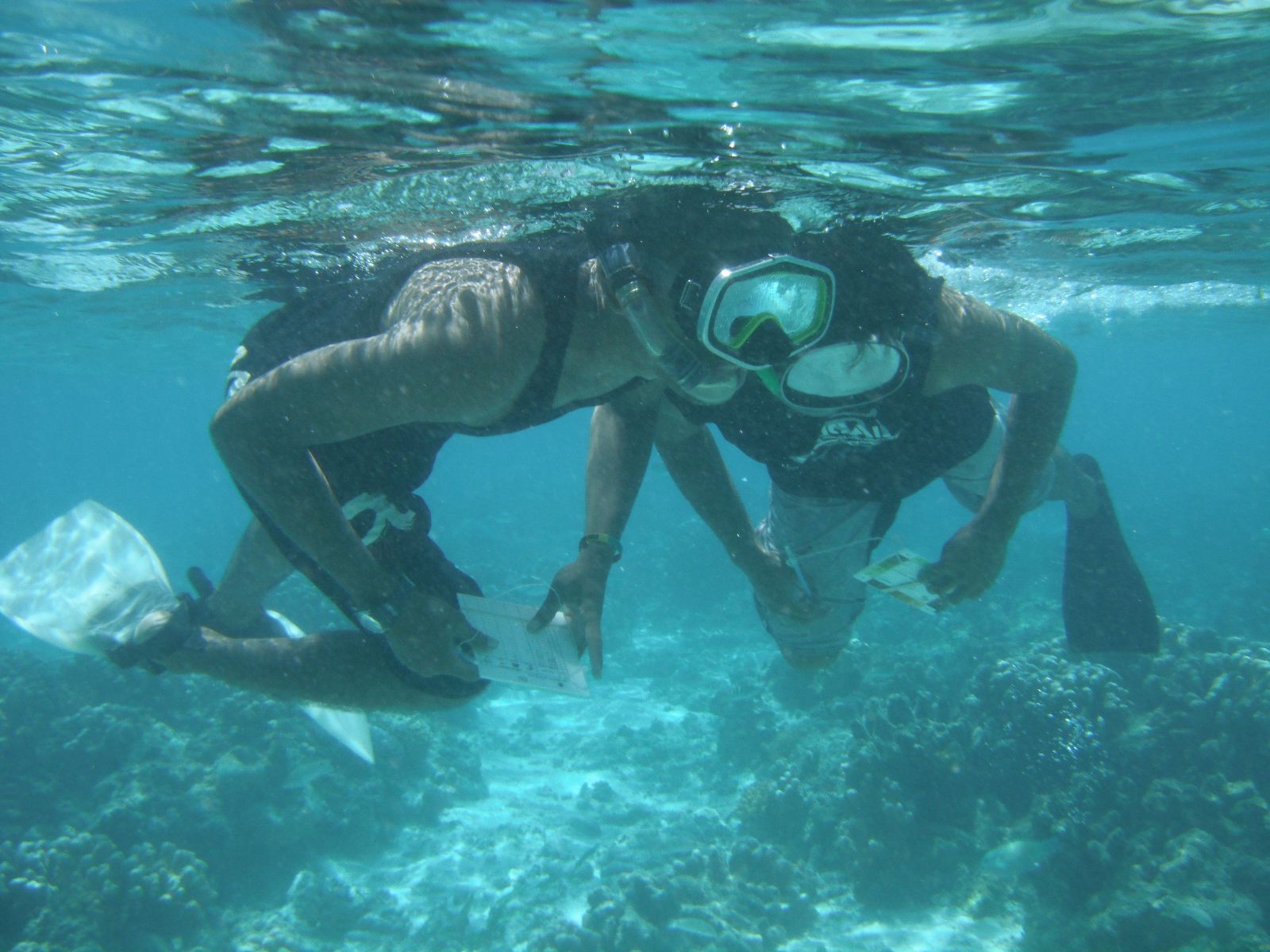 |
Using tools such as Coral Watch to collect valuable information about our coral reefs will be used to help improve coral reef management here in the CNMI |
Managaha
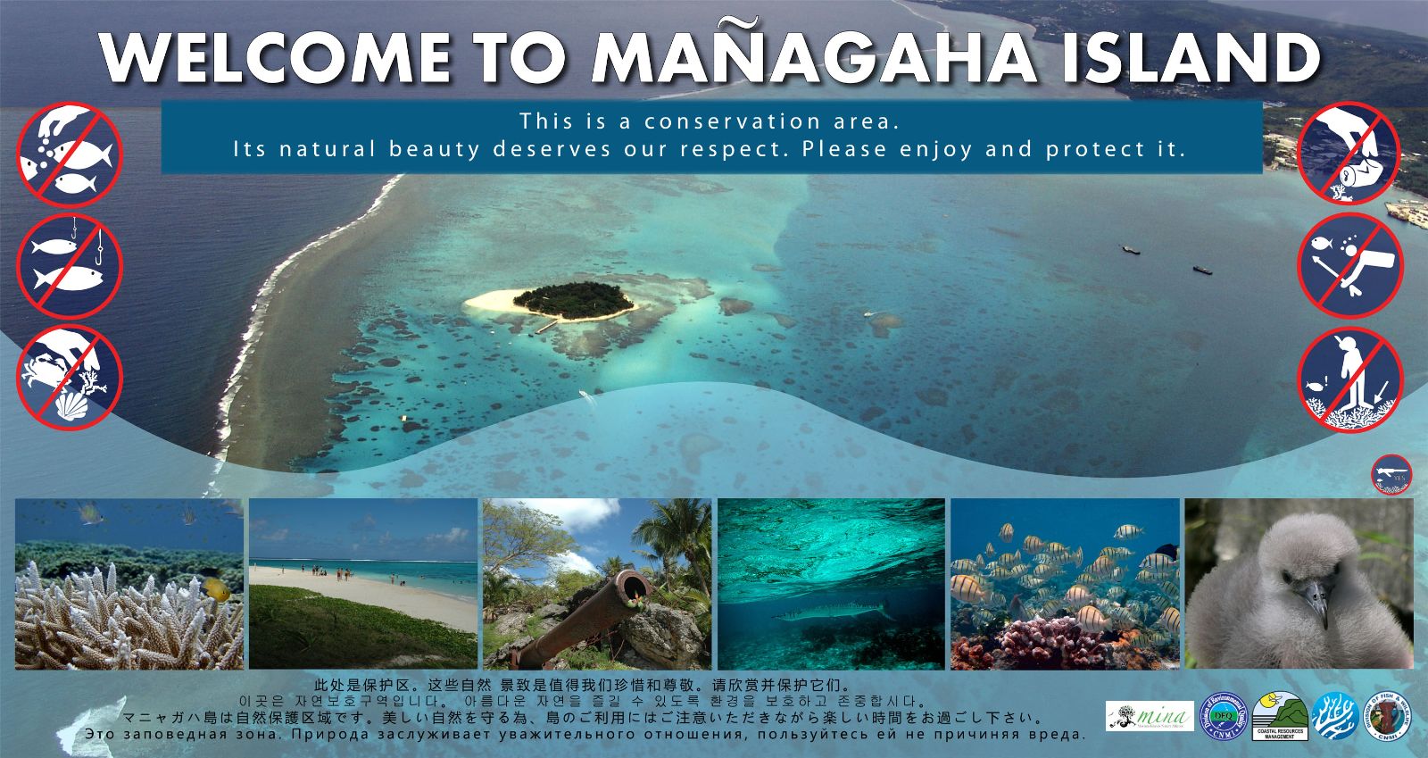
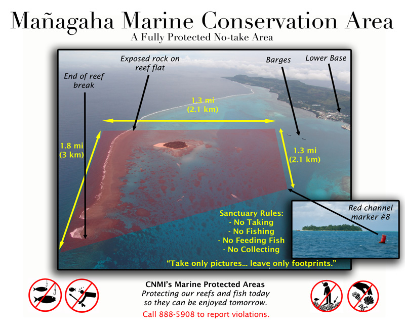
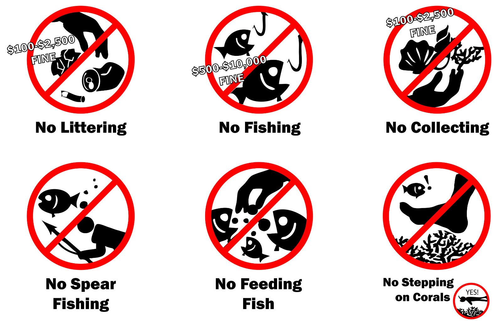
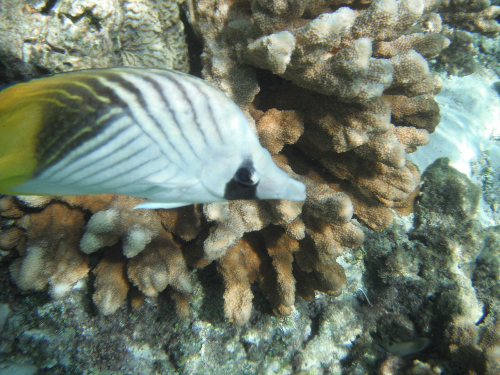
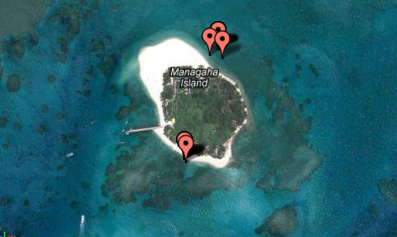
Managaha Island is a small (4 ha) reef island that sits off the western coast of Saipan. The CNMI Public Law 12-12 that established the Managaha Marine Protected Area (MMCA) was passed by the CNMI’s 12th Legislature to protect and preserve Managaha Island’s rich and diverse corals and fish species, historical and cultural significance, and natural beauty. MMCA is a fully protected No-take reserve visible from the western coastline of Saipan. Encompassing 500 ha within the Tanapag lagoon and the adjacent reef slope (Figure 1), the conservation area covers about 12% of the Saipan lagoon (CNMI DFW). At least 240 species of hard corals and 31 species of soft corals and sea fans are found in these coastal waters (USFWS 1996) and more than 100 fish species are known to use the conservation area (Myers 1991). Green sea turtles (Chelonia mydas) and Hawksbill sea turtles (Eretmochelys imbricata) were historically present in the conservation waters but are now considered rare (Berger, 2005).
The regulating agency responsible for the management of MMCA is the Division of Fish and Wildlife (DFW). The Division of Environmental Quality (DEQ) is primarily responsible for monitoring water quality within the conservation site while Coastal Resources Management Office (CRMO) monitors beach erosion on a semi-annual basis.
CoralWatch
What is CoralWatch?
CoralWatch is a non-profit research organization initiatied by biologists at the University of Queensland, Brisbane, Australia. This program is committed to helping maintain and conserve the coral reefs of the world to ensure that present and future generations may enjoy the natural wealth and beauty of the most diverse ecosystems on earth. It offers rapid assessment coral health monitoring and education tools used by anyone who wants to increase understanding of coral bleaching and contribute to the protecting of coral reefs worldwide.
How do I get involved?
Everyone can participate! The coral health chart can be used when diving, snorkeling, or reefwalking.
What is CoralWatch trying to achieve?
Increase understanding of coral reefs, coral bleaching and climate change and encourage reef protection (through interactive learning and monitoring tools)
What is coral bleaching?
Coral bleaching is the whitening of coral due to a loss of symbiotic algae living within the coral tissue. In healthy coral, algae supplies energy and provide color. During bleaching events, coral ejects the algae from their tissue which changes the color of the coral. As coral expels more algae the coral becomes lighter in color. Back to Top
Project's Progress
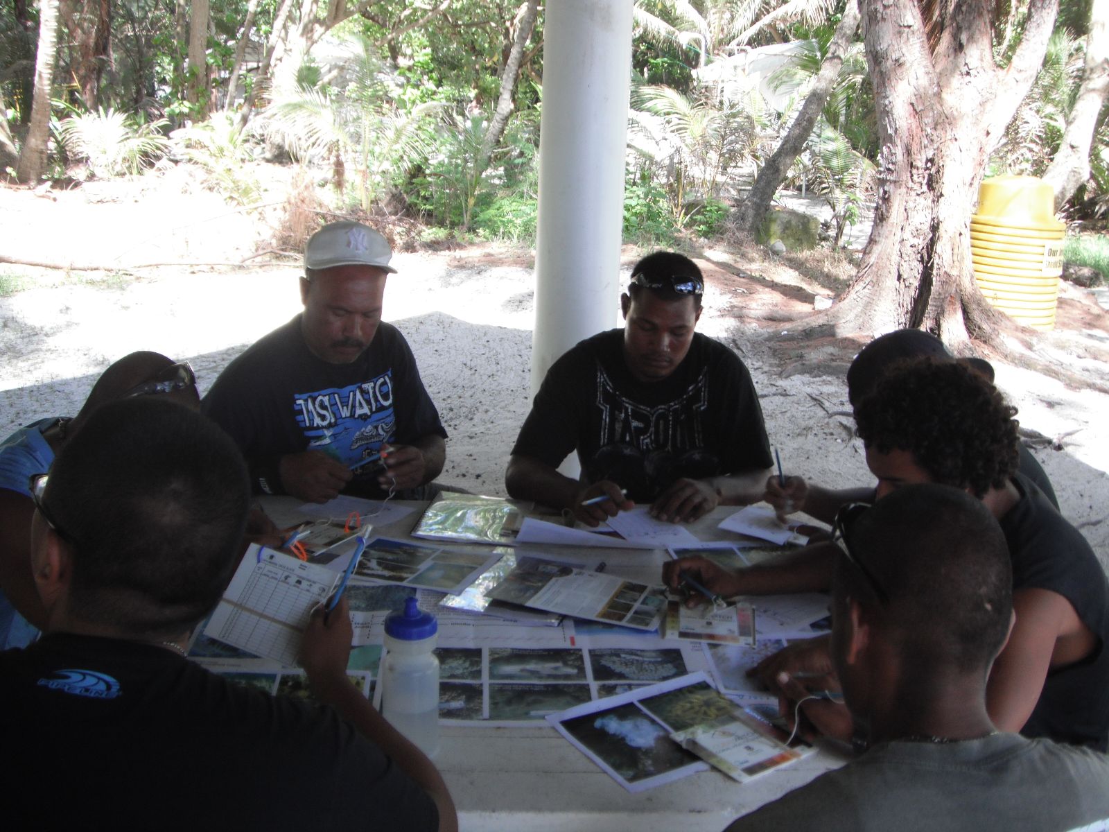
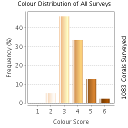
So far we have approximately 70+ volunteers for the "Enhancing the Managaha Experiecnce" Project. Together with our volunteers we have been able to monitor coral bleaching within the shallow waters off of Managaha Island conducting eight (8) CoralWatch Activities to date. Of those CoralWatch Activities, MINA surveyed up to 1083 corals using the CoralWatch Health Chart . To join MINA in collecting valuable information about Managaha's reefs, you can join us on our upcoming events.
September Events
Friday 8/24 9:00 am - 1:00 pm
Friday 8/31 12:30 pm - 3:30 pm
Saturday 9/8 8:00 am - 1:00pm
Saturday 9/15 10:00 am - 2:30 pm
Saturday 9/22 10:00 am - 2:30 pm
Saturday 9/29 10:00 am - 2:30 pm
For more information about CoralWatch, visit www.coralwatch.org or click on http://www.youtube.com/watch?v=KK0UETMImGw
Coral Watch on Managaha as of 8/14/2012
|
Fig. 1: Average color score between light and dark shading over time begining May 2012 to present (August 2012). |
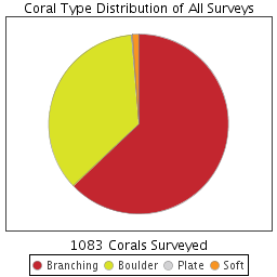 Fig. 2: Distribution of surveyed corals in the Managaha NE Reef Fig. 2: Distribution of surveyed corals in the Managaha NE Reef |
Fig. 3: Color frequency of coral distribution in the Managaha NE Reef |
.png)
Social Science
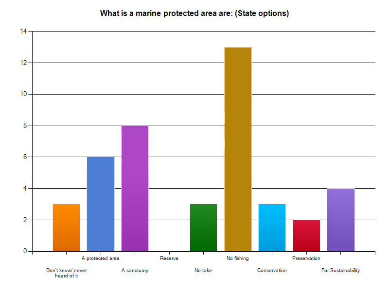
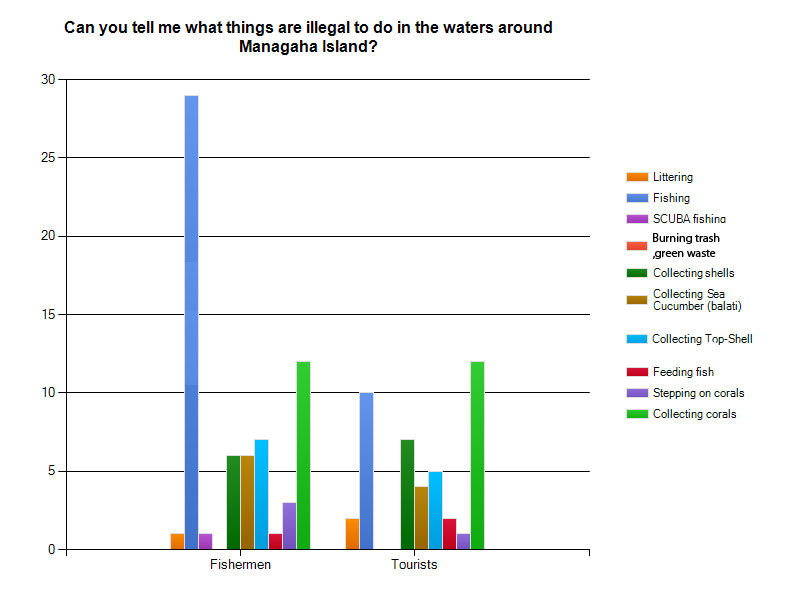
To get an understanding about what our community thought about Marine Protected Areas, a brief social survey was conducted targeting fishermen here in the CNMI.
|
Fig. 4: Fishermen's knowledge of Marine Protected Areas in the CNMI (n=33) |
|
Fig. 5: Fishermen's thoughts about which activities were illegal for both fishermen and tourists to do on Managaha (n=33) |
Funding for this project is provided through a grant from the Micronesia Conservation Trust
Last Updated 6/3/2015